
Connecticut Residential Zoning Analysis

Through forbidding zoning regulations for multifamily housing, some Connecticut towns excluded certain population from their communities. Picturedigits helped Fionnuala Darby-Hudgens at Connecticut Fair Housing Center to visualize zoning laws to help illustrate that.
Interface
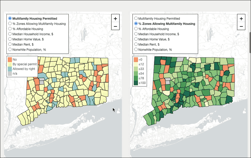
Two side-by-side maps allow to compare two of seven available variables for towns, such as median household income vs percent of housing classified as affordable.
An interactive scatterplot allows to view the same data, but as points instead of geographical locations. One can easily see that town's median household income negatively correlates with percentge of affordable housing.
Another visualization shows minimum multifamily housing lot size for each town, and the maximum number of units per acre ("density") that can be constructed on such lot. Icons of homes (=unit) and squares (=acre) were used to draw comparisons.
Data
All zoning data was collected by Fionnuala Darby-Hudgens at Connecticut Fair Housing Center.