We make maps, build interactive interfaces, and develop AI tools that help organizations understand, communicate, and act on their data.
Say [email protected].
For US inquiries, contact [email protected].
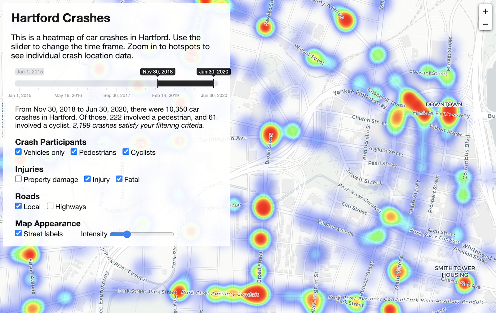
Hartford Crashes
Interactive heatmap for the last 5½ years of crashes in Hartford, Connecticut
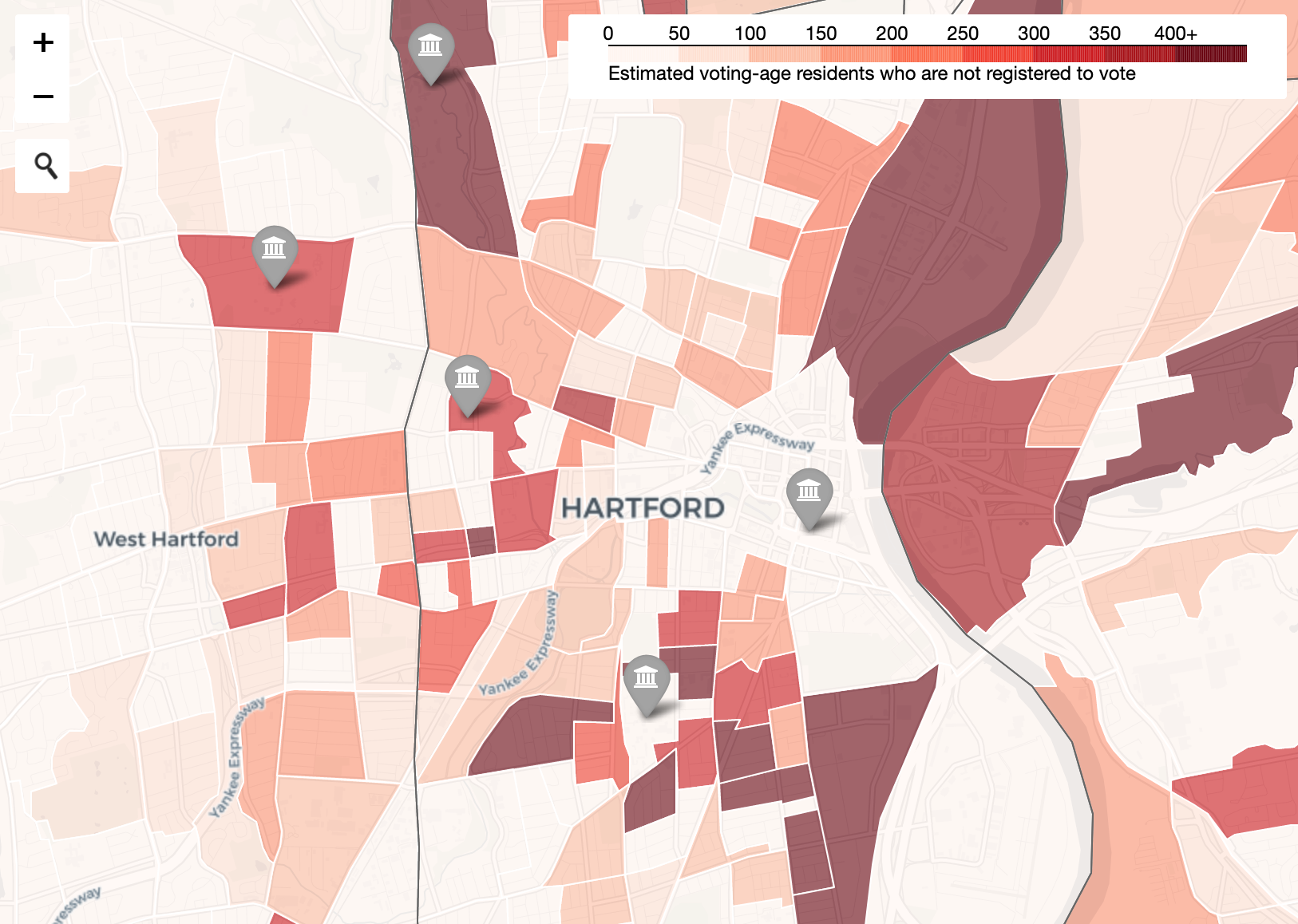
Get Out the Vote Map
Interactive map of potential unregistered voters by census block group in Connecticut
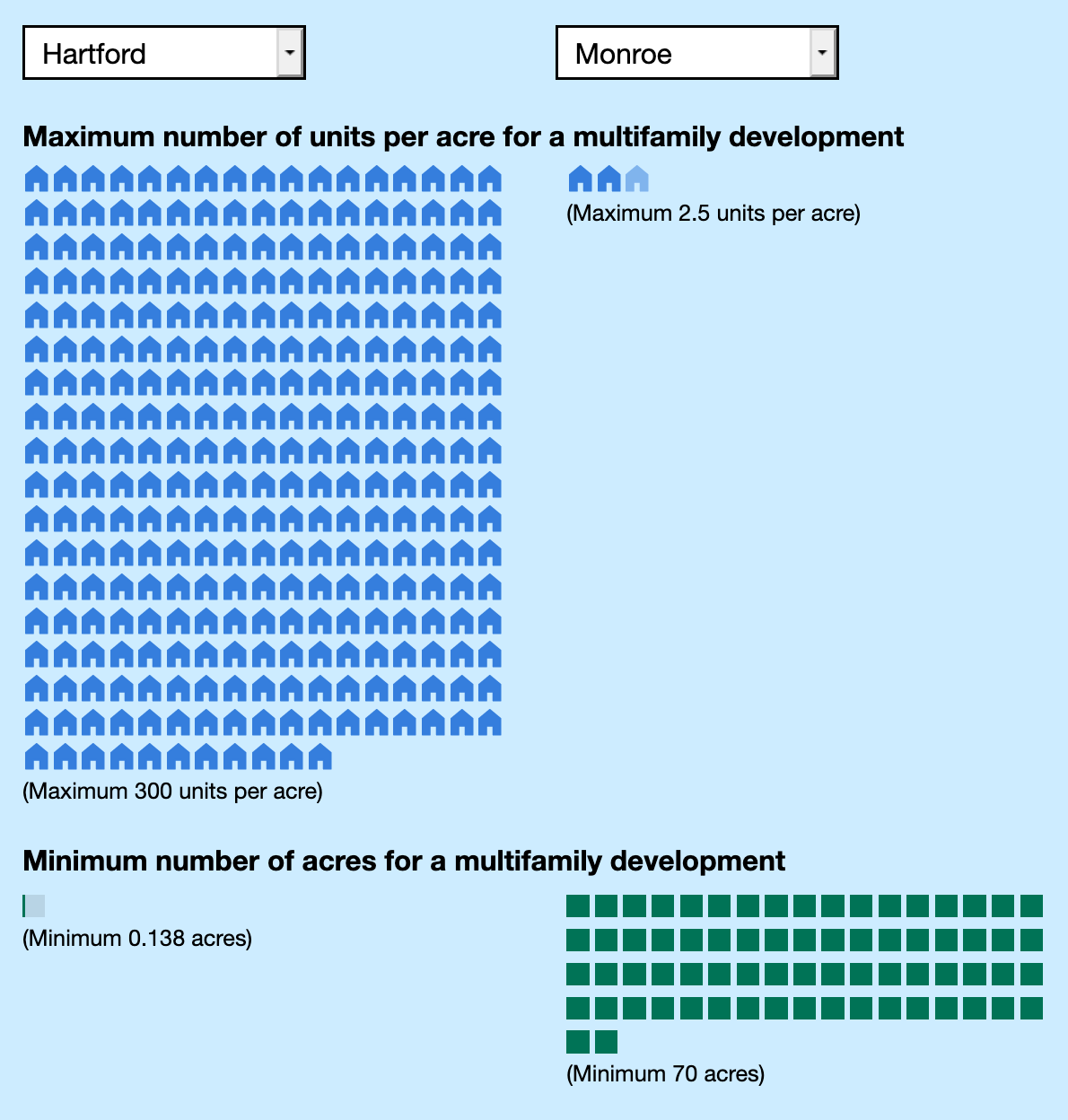
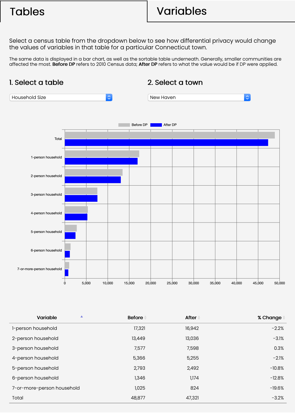
Connecticut Residential Zoning Analysis
Visualizations to explore town zoning regulations in Connecticut